|
|
Government Of India India Meteorlogical Department Meteorological Center, Hyderabad |
|
|
Government Of India India Meteorlogical Department Meteorological Center, Hyderabad |
16-Sep-2025(at 16:30 Hrs IST)
IMPACT BASED FORECAST FOR HEAVY RAINFALL OVER HYDERABAD CITY & NEIGHBOURHOOD
| Date | 16-Sep-2025 | 17-Sep-2025 |
| Forecast | Generally cloudy sky. Light to Moderate Rain or Thundershowers accompanied with gusty winds (30-40 kmph) very likely to occur in the city towards evening or night. Mist or Hazy conditions are very likely to prevail during morning and night hours. Surface winds are likely to be Westerlies/South-westerlies with wind speeds around 04-06 kmph. | Partly cloudy sky. Light Rain or Thundershowers accompanied with gusty winds (30-40 kmph) very likely to occur in the city towards evening or night. Mist or Hazy conditions are very likely to prevail during morning and night hours. Surface winds are likely to be Westerlies/South-westerlies with wind speeds around 04-06 kmph. |
| Impact Expected |
|
NIL |
| Activity Suggested |
|
No action |
| COLOUR CODES | |
| Risk Level | Response |
| Very Low | No Action |
| Low | Be Updated |
| Medium | Be Prepared |
| High | Take Action |
| Terminology | Rainfall Range | Terminology | Rainfall Range in mm |
| Light Spell | 1 cm/hr | Very Intense Spell | 3-5 cm/hr |
| Moderate Spell | 1-2 cm/hr | Extremely Intense Spell | 5-10 cm/hr |
| Intense Spell | 2-3 cm/hr | Cloud Burst | >10 cm/hr |
| Terminology | Rainfall Range in mm | Terminology | Rainfall Range in mm |
| Very Light Rainfall | Trace-2.4 | Heavy Rainfall | 64.5-115.5 |
| Light Rainfall | 2.5-15.5 | Very Heavy Rainfall | 115.6-204.4 |
| Moderate Rainfall | 15.6-64.4 | Extremely Heavy Rainfall | >=204.5 |
| Latest Sattelite image |
 |
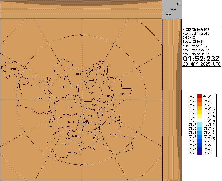
| Latest Radar image |
 |